
 November Daily Weather Report
Hallo Bay * Homer
Webcams: Live 24/7
Homer~Kachemak Bay
Homer Birdcam
HOMER
Lat/Lon: 59.7° N 151.5° W
Weather Conditions: Snow! Snow mixing with rain toward Kachemak Bay. Snow accumulation 1 to 3 inches along Cook Inlet. Little or no snow accumulation inland. Tonight rain and snow around Kachemak Bay and a chance of snow elsewhere. Little snow accumulation. Lows in the upper 20F to mid 30F (-3.3c to 1.7c). Highs in the mid 30F to lower 40F (1.7c to 4.4c) ***See weather update below
Visibility: 5 miles
Ceiling: 1,500'
Wind: SE 10 to 20 mph. Around Kachemak Bay SE 10 to 20 mph increasing to 20 to 35 mph, gusting to 45 mph in the afternoon. Tonight E 10 to 20 mph. Around Kachemak Bay SE 15 to 30 mph, gusting to 45 mph, decreasing to S 20 mph after midnight
Barometric Pressure: 29.58 Falling
Outside Humidity: 96%
Tigger Forecast: it's snowing ~ curled up warm 'n cozy snoozing!
Actual Sunrise: 9:31 AM AKDT
Actual Sunset: 6:06 PM AKDT
Civil Twilight Sunrise: 8:46 AM
Civil Twilight Sunset: 6:51 PM
Moon Rise: 3:59 PM
Moon Set: 1:18 AM
Moon: Waxing Gibbous, 63% of Moon illuminated
Length of Visible Daylight: 10h 04m
Length of Day: 8h 34m
Tomorrow will be 5m 2s shorter
THIS DATE IN ALASKA HISTORY: November 3, 1942 -
Construction crews building the Alaska Highway from the north and south met at "break through," 20 miles east of the Alaska boundary
AURORA FORECAST: Quiet (1)
AURORA LIVECAM
METEOR SHOWERS: South Taurids: November 2, 3, 4
10/20 hrly rate, very slow, bright display, view S 1~3am

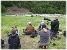
HALLO BAY
58º 34’10.10 N, 153º 53’57.58 W
Weather Conditions: Inland areas snow, heavy at times mixing with rain in the afternoon. Areas of blowing snow may reduce visibility to one half mile or less at times. Snow accumulation 3 to 7 inches. Tonight rain in the evening, then rain and snow after midnight. Snow accumulation up to 1 inch. Lows around 30F (-1.1c). Highs in the lower 30F to lower 40F (-1.1c to 4.4c). Wind SE 20 to 35 mph, tonight becoming SW 10 to 25 mph after midnight. Local gusts 45 to 65 mph along the western capes and the Alaska Peninsula ***See updated weather report below
Actual Sunrise: 9:46 AM AKDT
Actual Sunset: 6:21 PM AKDT
Civil Twilight Sunrise: 9:01 AM
Civil Twilight Sunset: 7:06 PM
Moon Rise: 4:14 PM
Moon Set: 1:34 AM
Have a Safe Day!
►Breaking News Weather Update: Batten down the hatches: A monster of a storm is forecast to hit Southcentral Alaska this afternoon, according to the National Weather Service, with major snow accumulation for West Prince William Sound and hurricane wind gusts up to 80 mph in Anchorage. Blizzard-like conditions were a possibility across much of the state, from the Yukon-Kuskokwim Delta region through the Mat-Su Valley and Anchorage Bowl and beyond, to the Kenai Peninsula. Here is a rundown of the predicted snow accumulation in the Valley, Anchorage and beyond to Girdwood and Kenai. Read more here


 Alaska Time
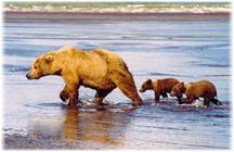


No comments:
Post a Comment